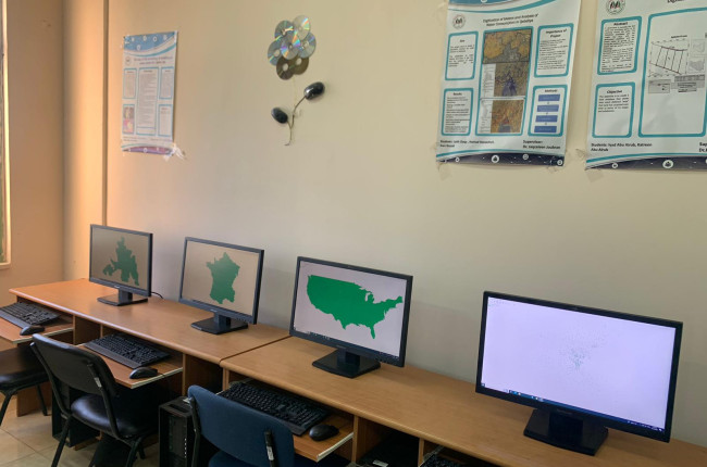
The Geographic Information Systems (GIS) Laboratory at the Faculty of Information Technology is a specialized facility that provides students with an ideal environment to learn and apply GIS technologies. The lab is equipped with advanced software that assists students in analyzing geographic data, producing digital maps, and creating spatial visualizations. Key programs used in the lab include ArcGIS, QGIS, ERDAS Imagine, and AutoCAD Map 3D, which allow students to work on a variety of projects, including spatial analysis, geographic forecasting, and geographic data management. The lab plays a key role in developing students' skills in areas such as surveying, geographic data analysis, and spatial planning, opening up broad career opportunities in fields like urban planning, environmental studies, and engineering.
Main navigation
- Main
-
About AAUP
Image


Give university
For those who wish to donate to the university, you can make your donations by filling out the donation form
-
Study
Image


Arab American University Library
A distinguished library at the local and international levels by providing all electronic and paper information resources.
-
University life
Image


Inspiring success stories from the Arab American University
Success represents the pinnacle of persistence in the face of failure. So, these are the success stories we will share with you that reveal the path taken by some of our university’s graduates.
-
University centers
- Center for Research and Polling
- Center of Excellence for Climate Change and Environmental Technologies
- Conflict Studies Research Center
- Continuing Education Center
- Dental Center
- E-Learning Center
- Hassib Sabbagh Center of Excellence
- Heart Center
- Language Center
- Medical Center - Ramallah
- National Digital Transformation Center
- Prosthetics and Orthotics Factory
- Simulation Center
Image

Medical Rehabilitation Complex
-
Research
Image


Arab American University Awards
As part of the university’s efforts to support and encourage scientific research, there are a set of awards to encourage researchers to excel in their original and valuable scientific production
-
Media Center
Image


AAUP ACADEMIC CALENDAR
An agenda to show the the important dates such as semester dates, registration, exams, activities, events, and holidays.


